A high Resolution (46 m) Operational Oceanographic System in Belfast Lough is near completion, and is composed of two components: (1) the HR operational oceanographic module, based on a bespoke Delft-3D hydrodynamic model, developed by project partners IH Cantabria, and (2) the HR oil spill forecast module, based on the oil spill model, TESEO. The system receives daily ocean and meteorological forcings from the European initiative “MyOcean” and the UK Meteorological Office, and provides two-day forecasts of sea level, currents, salinity and temperature based on numerical modelling. This web application allows end users to easily access the forecast and to launch the oil spill model to estimate the oil spill trajectories and fate both in case of pollution threat and for training purposes.
In addition, new instrumentation has been installed on Pile 8 within the Inner Lough, and plans are to embed a data-feed from these instruments showing live plots of temperature, salinity, sea level and meteorological readings.
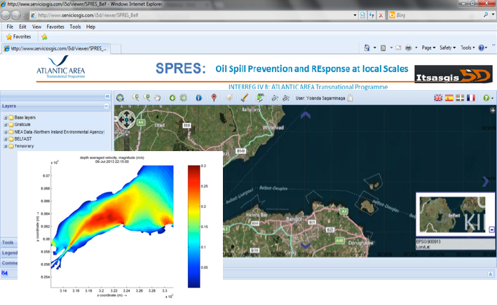
OOS interface running through the ITSASGIS5D web platform
RISK ASSESSMENT SYSTEM
Belfast Lough
A vulnerability assessment of the shoreline was performed using the methodology of the NOAA’s Environmental Sensitivity Index (ESI) shoreline classification. A detailed shore survey has been completed (2013-2014) following interpretation of aerial imagery for the shoreline. Habitat information (translated into EUNIS biotopes) and physical information was gathered regarding the substratum and exposure, slope angle and any manmade features. This information was then used to assign ESI categories to the shoreline, allowing lower shore and upper shore to be described and represented as GIS shapefiles.
In term of ecological sensitivity, most of the inner Lough is designated as an open water Special Protection Area (SPA) under the EC Habitats Directive. There are also a number of shoreline SPAs and many Areas of Special Scientific Interest (ASSI) both for the wildlife and geological features of the area. In terms of socio-economics, subtidal aquaculture for mussels in the inner lough, pot fishing, and scallop dredging in the outer lough are activities very sensitive to oil pollution. The Port of Belfast is a very busy shipping port, which handles over 80% of Northern Ireland’s petroleum and oil imports, and receives over 5,000 vessels each year. In addition to the Port of Belfast, Carrickfergus Harbour and Bangor Harbour are also located within the lough. Recreational sailing is also increasing within the lough with notable marinas. A highly popular beach at Crawfordsburn (most visited leisure spot in Northern Ireland) is located on the southern shore of the lough. Kilroot Power Station, located on the north lough shore, is served by a jetty (importing coal and oil), and there is a contingency stockpile of diesel served by Cloghan Point Jetty also on that shore. Significant disruption could be caused by spills in any of these areas.
Similarly to other study areas, the oil spill hazard component of overall oil spill risk has been defined for Belfast Lough based upon a statistical analysis of the results from 74 spill points at 816 different wind, tide and freshwater flow scenarios. The maps and results of both the vulnerability and hazard components are uploaded in the WebGIS platform ITSASGIS5D. Currently, a plugin for calculation of risk based on the overlay of these components is under development.
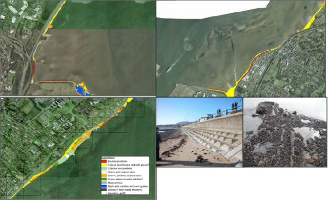
Shore survey to enhance information available for (a) vulnerability assessment, and (b) determination of appropriate clean up techniques around the lough.
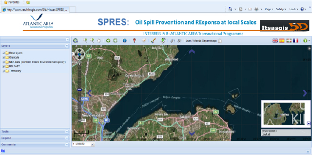
Figure XX. Tools interface including oil spill trajectory modelling and risk assessment tool (under development)
As part of Activity 6, AFBI and Cedre have been working closely with Belfast Harbour to appraise the existing booming plans developed for the Harbour as part of their oil spill contingency plans. AFBI has utilised the oil spill trajectory model and hydrodynamic model to run a number of scenarios of interest to the port, to see how well their fixed booming points would work in such situations. In addition, drifter buoys have been utilised to validate such model predictions.
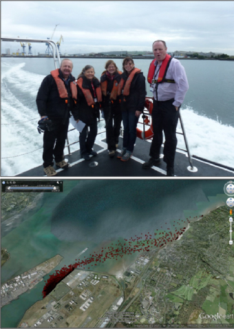
Port of Belfast booming plan appraisal